“Recent scientific evidence across disciplines points to an unstable Greenland Ice Sheet (GrIS), which is particularly concerning in view of a rapidly changing Arctic system, its impacts on local communities and ecosystems, and the regional and global impacts of sea-level rise.”
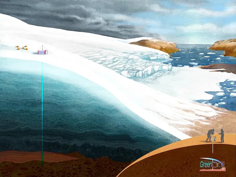
In June 2023, the GreenDrill Project, made history by drilling down to the ice bed through 509 m of ice at Prudhoe Dome, NW Kalaallit Nunaat (Greenland). Using the large ASIG drill the team reached the bed within a 6 week period, where they recovered a 7.4 m core of frozen sediments and bedrock. This is a scientific and engineering first, and the result of a major collaboration of science and engineering. Prudhoe Dome is the first in a series of 4 deep drill locations that this project hopes to attain around the northern perimeter of the Greenland Ice Sheet.
The science team has been working with the U.S. Ice Drilling Program to develop and execute an aggressive drill plan that includes drilling through the Greenland Ice Sheet in strategically selected locations around the top of northern Greenland to recover rock samples from the bed beneath in order to get direct information about the history of the ice cover. At each location, a transect of three sections of bedrock is to be collected, stretching from off the edge of the ice in towards the interior, with the innermost drill site going deep down through hundreds of meters of ice to get to the bedrock below. The chemical signature sealed in the rock could tell the story of how the ice sheet responded to past periods of global warming, information that is critical to understanding past and future sea level rise.
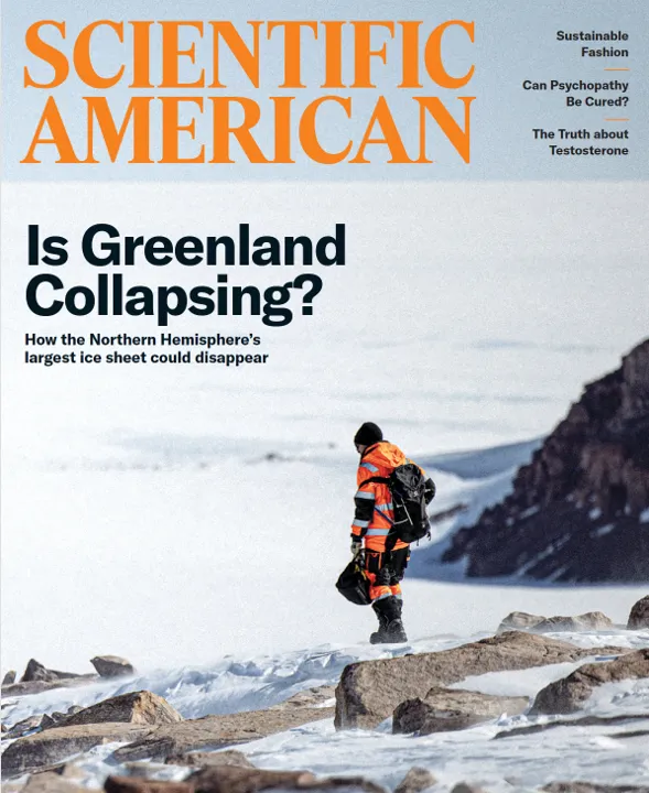
GreenDrill was featured on the cover of the July&August 2025 issue of the Scientific American. Read the feature here.
The above short video clip was collected by the GreenDrill team Spring 2023 as they drilled through the NW corner of the Greenland Ice Sheet at Prudhoe Dome. Drilling more than 500 meters through the ice to reach the bedrock below! This historic feat was filled with many anxious moments, and what at times seemed like overwhelming challenges, when the mission ultimately achieved its goal. Here is the full Washington Post story by Sarah Kaplan and her colleagues.
What is the GreenDrill Project?
GreenDrill is a revolutionary project designed to test the sensitivity of the northern Greenland ice sheet to answer critical questions like:
- How vulnerable is the ice sheet to our warming climate?
- What area of the ice sheet is most vulnerable, contributing the first few centimeters of sea level rise?
- When would we expect this to occur?
Answers to these questions are locked in the bedrock archive buried under the Greenland Ice Sheet. Pursuing answers has triggered mobilization of the first large Greenland ice drill program in over a quarter century.
GreenDrill is a 5-year, multi-million dollar project funded by NSF that brings together researchers from Lamont-Doherty Earth Observatory, University at Buffalo, University of Massachusetts Amherst, and Penn State, and harnesses the resources of the U.S. Ice Drilling Program.
GreenDrill addresses the climate vulnerability of the northern regions of the Greenland Ice Sheet by drilling transects of 3 cores through the ice in 4 different locations.
This Science Magazine article provides a project overview.


Pro-GrIS landscape in Inglefield Land, Northwest Greenland, during the first GreenDrill field season.
The bedrock, weathered rocks and sediments in the foreground have been deglaciated relatively recently, and represent a natural example of how 'the bed' under the GrIS actually looks like.
Video Highlights
The GreenDrill project launched in the midst of a series of unprecedented global challenges that appeared from seemingly nowhere. Project PIs Jason Briner (U@B) and Joerg Schaefer (LDEO) reflect on the magnitude of the project and the imperative to move the project forward and continue the work, with additional planning and collaboration. Film by Ryan Vachon, INSTAAR.
Debuting on American Geophysical Union TV at the December 2022 meeting (#AGU22), GreenDrill researchers Joerg Schaefer, Gisela Winckler, Allie Balter-Kennedy, and Margie Turrin of Lamont-Doherty Earth Observatory and University at Buffalo's Jason Briner discuss their work to diagnose the trauma to Greenland's ice sheet, and pinpoint its most vulnerable areas and impacts to coastal communities.
GreenDrill is funded under the National Science Foundation (NSF) Office of Polar Programs.